Description
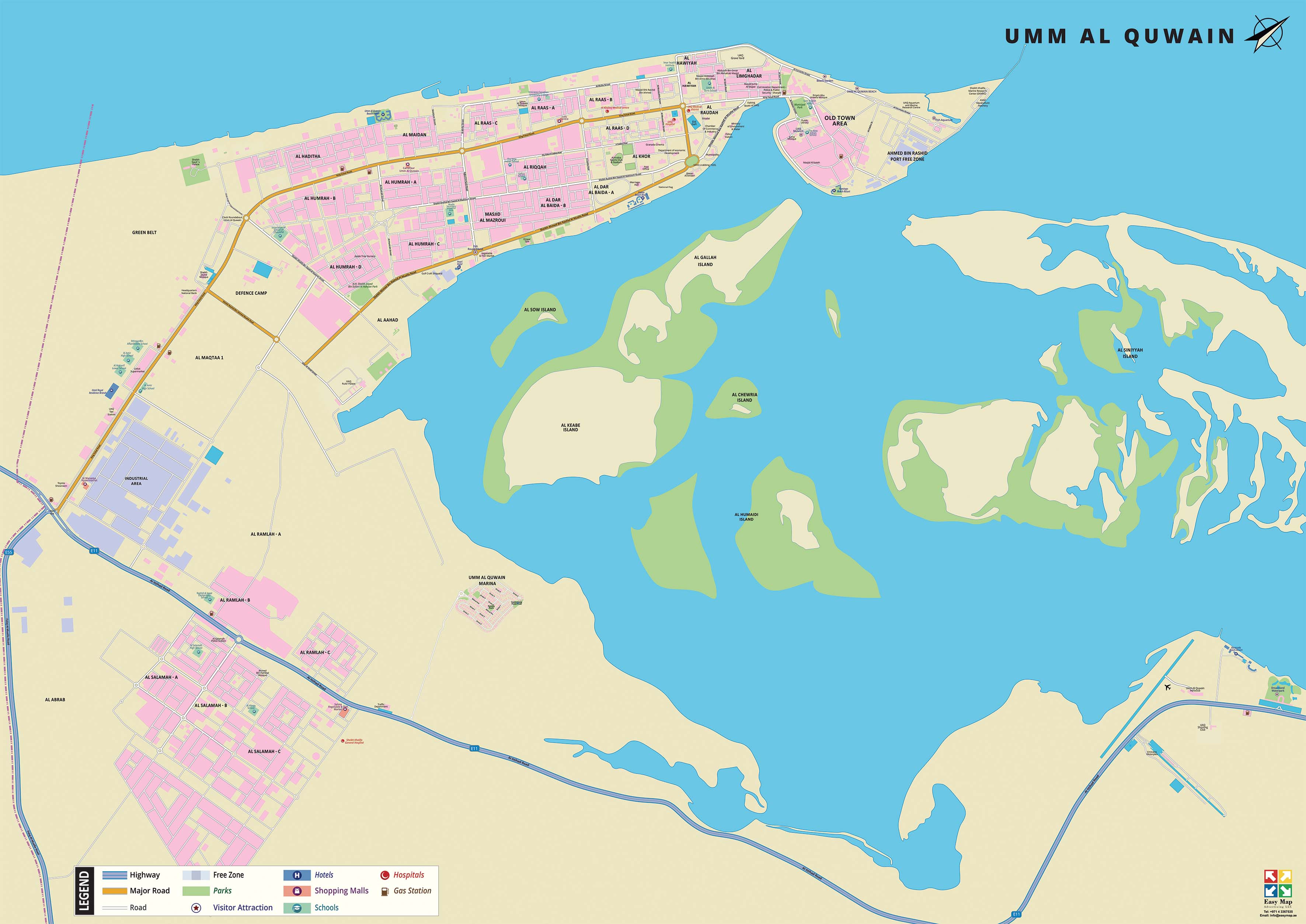
This 2D map shows areas, highways, major roads, free zone area, islands, parks, shopping malls, attractions, schools, hospitals, hotels and resorts etc., within the Emirate of Umm Al Quwain. Currently, the map is available in English but can be customized in other foreign languages as per request. It serves as an excellent wall map to dress your office or home walls.
Map spreads across:
From left to right: Industrial area, Al Abrab to Al Siniyyah Islands
From top to bottom: Arabian Gulf Old Town Area to Al Salamah, Umm Al Quwain Shooting Club and Dreamland Waterpark
